Mount Talamau hiking adventure is necessary for nature lovers and trekking enthusiasts visiting West Sumatra. Known as the highest peak in the region at 2,982 meters above sea level, Mount Talamau offers more than just elevation—it features 13 stunning summit lakes, breathtaking forest landscapes, and a trail filled with both natural beauty and mystique. Its unique combination of three peaks and hidden alpine lakes makes it one of Indonesia’s most underrated hiking destinations.
The Natural Beauty of Mount Talamau
This Mount Talamau hiking adventure is ideal for intermediate to experienced climbers, offering a rewarding combination of challenge and serenity. As you reach the summit, you’ll journey through untouched tropical rainforest, home to rare plants and animals. The trail features steep rocky paths that test your stamina but reward you with unforgettable views.
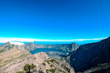
From the summit, hikers can witness the magical sight of 13 lakes, often surrounded by clouds hovering above the lush valleys below. These mystical summit lakes are a highlight of the climb.
The 13 Lakes at the Summit of Mount Talamau
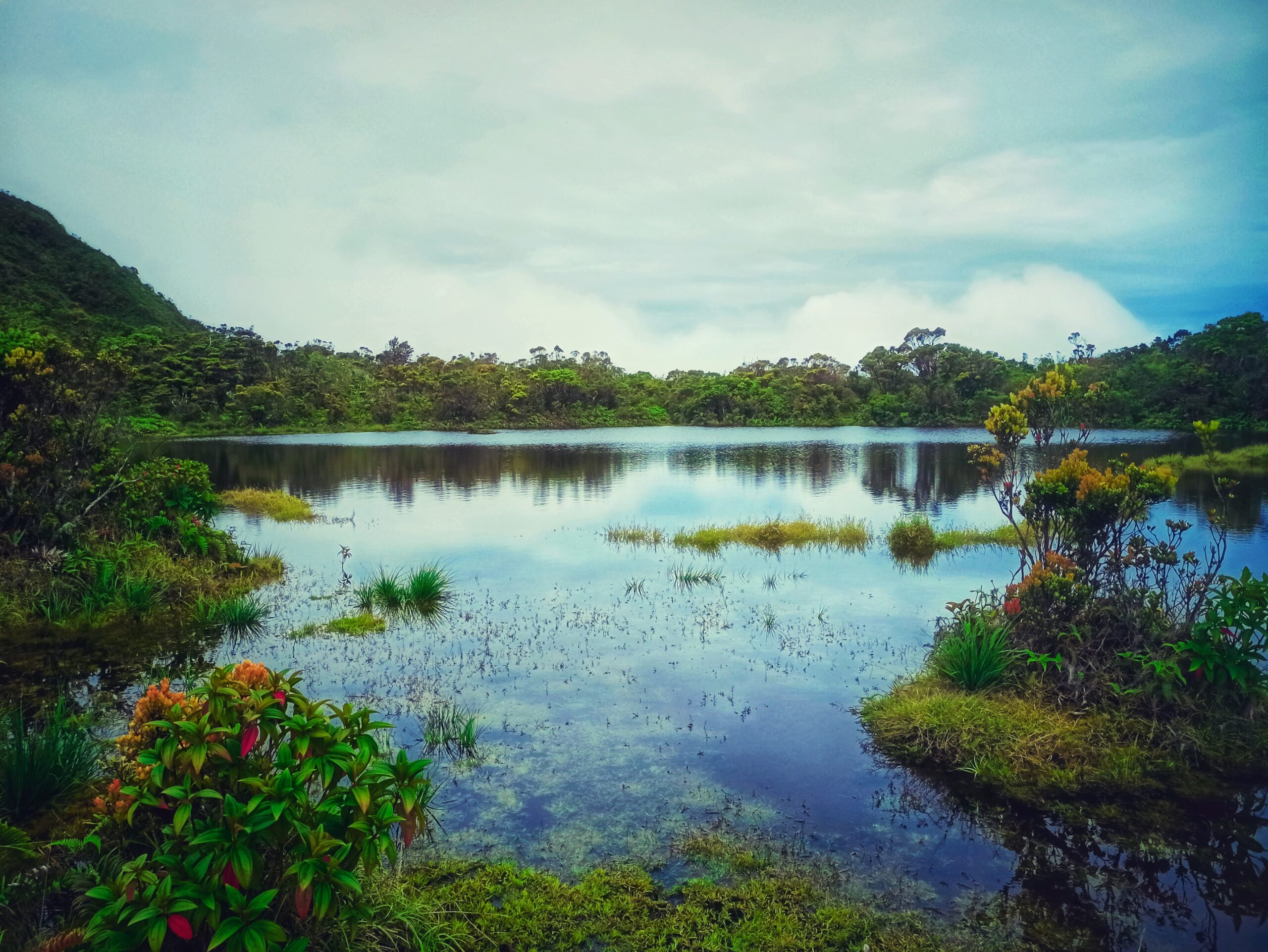
Telago Puti Sangka Bulan is one of the lakes on Mount Talamau.
Here are the names of the 13 mystical lakes you’ll find at the summit:
-
Talago Biru
-
Talago Buluah Parindu
-
Talago Cindua Mato
-
Talago Imbang Langik
-
Talago Lumuik
-
Talago Mandeh Rubiah
-
Talago Puti Bungsu
-
Talago Puti Sangka Bulan
-
Talago Rajo Dewa
-
Talago Satwa
-
Talago Siuntuang Sudah
-
Talago Tapian Puti Mambang Surau
-
Talago Tapian Sutan Bagindo
These lakes add to the magical charm of Mount Talamau and make it one of the most unique mountain destinations in Indonesia.
Unique Flora and Fauna
The forests around Mount Talamau are home to rare plant and animal species. Whether you’re a biologist, photographer, or simply a curious traveler, you’ll find nature in its purest form here — untouched, diverse, and alive.
Hiking Mount Talamau: A Challenging but Rewarding Journey
The hike up Mount Talamau is known for being quite challenging, but it’s accessible for those with intermediate to advanced hiking experience. Here’s a breakdown of the checkpoints you’ll pass on the way up:
1. Pinaga Village – Basecamp / Post 1
Pinaga Village is the starting point of the hike. Hikers must register and go through a gear check at this post. From here, you’ll follow markers at KM 11, KM 12, KM 13, and KM 14.
2. Bukik Harimau Kampo – Post 2
At 710 meters above sea level, this post features a hut managed by a local hiker who volunteers to preserve the mountain’s natural beauty. blog.eigeradventure.com
3. Pondok Rindu Alam – Post 3
Also known as Sari Bunyibunyian, this post lies at 1,100 meters. It takes around 2.5 hours to reach. There’s no shelter here, but a small river provides a clean water source.
4. Bumi Sarasah – Post 4
At 1,860 meters, this post has a small shelter and fresh water from a nearby stream. Reaching this post typically takes 2–3 hours.
5. Paninjauan – Post 5
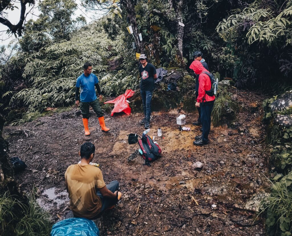
Paninjauan Post 6 — a resting point for hikers along the trail
Sitting at 2,500 meters, this is one of the steepest parts of the trail. The narrow path and elevation require strong physical stamina.
6. Rajawali Putih – Post 6
This post is at over 2,800 meters and is only around 75 minutes from Post 5. It features a wide grassy field known as Padang Siranjano, a perfect place to camp. It’s also close to the 13 summit lakes.
7. The Three Peaks of Mount Talamau
At the summit, hikers can visit all three peaks of Mount Talamau:
-
Puncak Trimarta (Main Peak)
-
Puncak Rajawali (Second Peak)
-
Puncak Rajo Dewa (Third Peak)
All 13 lakes can be seen from these vantage points — a surreal sight few will ever forget.
Best Time to Visit
The dry season (April to October) is best for this adventure. During the rainy season, the trails can become dangerously slippery, so avoiding hiking outside of the dry months is strongly advised. For up-to-date weather forecasts, check BMKG Indonesia.
How to Get There
Route from Padang City
-
Travel by bus, private car, or motorcycle to Terminal Bingkuang in West Pasaman. gunung.id
-
From there, continue to Kanagarian Pinagar, the official entry point.
Route from Rao (North Sumatra Border)
-
Less developed, but still possible. Requires more effort due to limited transportation. gokepri.com
Tips for Hiking Mount Talamau
-
Prepare Physically
Train for a few weeks before the hike. The route demands physical endurance and strong legs. -
Bring Proper Gear
Essentials include hiking boots, a waterproof jacket, a flashlight, a tent, and enough food and water. -
Leave No Trash
Respect nature. Bring all your trash back with you. -
Hire a Local Guide
For first-time hikers, hiring a guide is highly recommended for safety and route navigation.
Conclusion: Discover the Hidden Gem of West Sumatra
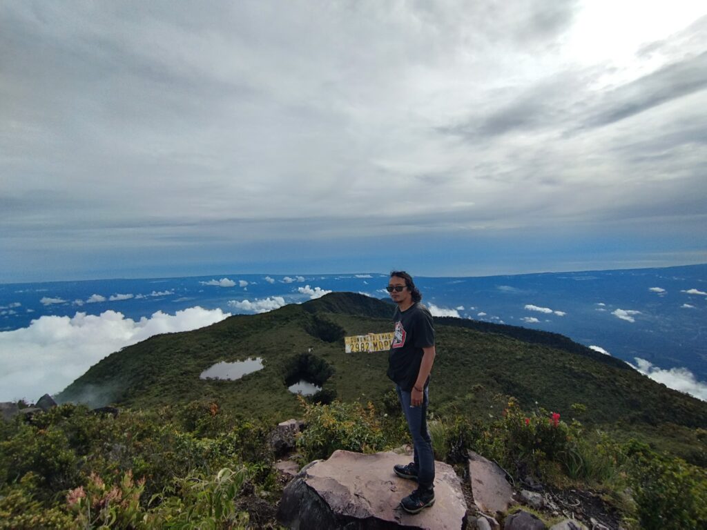
Mount Talamau Summit – 2,982 meters above sea level (masl)
Mount Talamau is a true hidden gem for anyone seeking a blend of adventure, nature, and serenity. With its 13 mystical lakes, lush rainforests, rare wildlife, and challenging trails, it promises a magical and unforgettable hiking experience.
If you’re looking to escape into nature and discover one of Indonesia’s best-kept secrets, Mount Talamau is calling. Pack your bag, gather your team, and get ready to witness the spellbinding beauty of this natural wonder.